LAND INFO has been named to the 2026 Inc. 5000 list of America’s fastest-growing private companies, its third appearance, based on three-year revenue growth.


Please follow us on LinkedIn for the most up to date news and information.
LAND INFO has been named to the 2026 Inc. 5000 list of America’s fastest-growing private companies, its third appearance, based on three-year revenue growth.
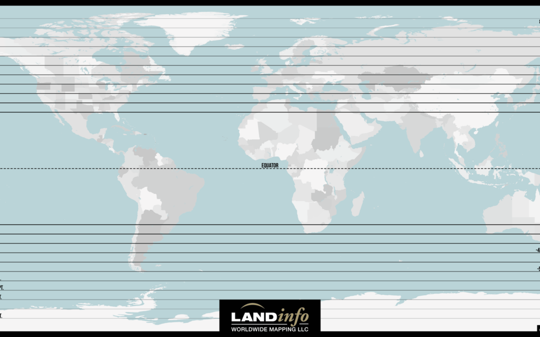
As winter approaches in the Northern hemisphere and the sun appears lower in the sky, our ability to optically image father north latitudes diminishes. This limitation is known as relative blackout, where minimum sun elevation (the angle of the sun above the horizon)...
DENVER, Colorado, USA, 16 February 2022 – LAND INFO Worldwide Mapping LLC, the premier provider of mapping solutions for 5G wireless in North America, recently completed up-to-date 10m resolution thematic raster GIS data covering all 50 U.S. states. Optimized for...
DENVER, Colorado, USA, 19 February 2020 – LAND INFO Worldwide Mapping LLC, the premier provider of mapping solutions for 5G wireless in North America, has assembled a world-class team of geospatial companies to extend its reach in the 5G industry in Europe. The LAND...
DENVER, Colorado, USA, 30 October 2019 – The Denver Business Journal has named LAND INFO Worldwide Mapping LLC one of fastest growing private companies in the Denver area. LAND INFO achieved 226% growth from 2016 to 2018 to make the 2019 Denver Fast 50 list. “The...
DENVER, Colorado, USA, August 2019 – LAND INFO Worldwide Mapping LLC has been named to the 2019 Inc. 5000 list of fastest-growing private companies in the United States. The firm credits its explosive three-year revenue growth to recent contract wins supporting 5G...
Three-dimensional city models are providing infrastructure intelligence in the race for network coverage. February 2019 Land Info has been providing market intelligence to help support telco companies in their preparation for emerging 5G rollouts across the U.S. Using...
"When it comes to determining what a particular object is, nothing beats a personal inspection. With a ground survey, one can see the object, and if necessary, photograph it, measure it and record notes about it. For small areas, this is a perfectly viable...
January 10, 2018 More than 10,000 maps for public consumers and 26,000 maps for intelligence community Toronto, ON, January 10, 2018 – Avenza Systems Inc., producers of MAPublisher® cartographic software for Adobe® Illustrator® and Geographic Imager® geospatial tools...
DIGITAL ELEVATION MODELS After a ~ 15 year wait the global (all land areas between 60° north and 56° south latitude) SRTM digital elevation model (DEM) coverage has been released at 1 arc second (30 meter) resolution. LAND INFO has this data available for immediate...