Medium Resolution Satellite Imagery
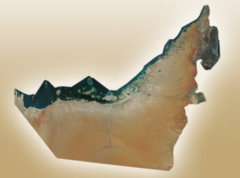
Medium-resolution imagery is ideal for covering large areas – countries, continents and in the case of Landsat and Sentinel the entire globe! While there isn’t a text-book definition of “medium-res” satellite imagery, for practical purposes it typically means resolution lower than 1m. Medium-res satellite imagery was traditionally offered on a scene basis, however newer medium-res satellites such as PlanetScope and SPOT 6 (SPOT 7 is now archive only due to an on-orbit failure) now support custom AOIs (Areas of Interest) with per km2 pricing.
Medium-res satellites typically offer additional multi-spectral bands, which make them ideal for image analysis/classification (as high-res satellites offering more than the usual four multi-spectral bands, WorldView-2/-3 and Pléiades Neo 3/4 are exceptions.) The larger collection swath width of most medium-res satellites allows them to collect larger areas in a shorter amount of time, giving better temporal selection/consistent seasonality.
With commercial medium-res satellites such as SPOT 6 imagery can be ordered as a custom new tasking or from archive (if the needed date/image type is in archive with acceptable parameters including cloud-cover), public-domain/government medium-res satellite imagery is only available from archive (the satellites follow collection schedules, they don’t accept custom requests.) PlanetScope is an outlier in that the satellites are always on so daily/intra-day attempts will be made with no need to place a custom order.
Off-shelf high-res ortho mosaics such as Vantor’s (Maxar) Vivid Basemap are also cost-effective solutions for large area coverage. Contact LAND INFO for additional details.
The table below lists many principal medium-resolution satellite imagery options; LAND INFO is an authorized distributor of both leading commercial medium-res satellite imagery providers: Airbus (SPOT-6 and SPOT-7) and Planet Labs (RapidEye and PlanetScope/Dove), and will be adding EarthDaily. We also work extensively with Sentinel-2A/2B/2C and Landsat-8/-9 and will work with niche satellites such as ALOS, ASTER, CartoSat, CBERS, DEIMOS-1, DMC, Formosat, Landsat-1, Landsat-2, Landsat-3, Landsat-4, Landsat-5, Landsat-7, SPOT-1, SPOT-2, SPOT-3, SPOT-4, SPOT-5, and Vision-1 as needed, for example date-specific coverage.
Contact LAND INFO for a custom tasking collection quote on commercial medium-res imagery or archive image search on commercial or public-domain medium-res imagery – we can also confirm processing options, value-added services including classification, streaming options, academic/EDU pricing and volume purchase discounts. You may also submit your project area via Land Info’s online SAT search tool.


Medium Resolution Satellite Imagery Specifications
ASTER SWIR collections malfunctioned April, 2008
TIR permanently turned off to conserve power
SPOT-5 Ceased collections March 30, 2015
ALOS-18 Ceased operations April, 2011
RapidEye Ceased collections March 31, 2020
DEIMOS-1
SPOT-6
SPOT-7 Ceased collections March 17, 2023
Landsat-8
Landsat-9
Sentinel 2A/2B/2C
Notes
- 1 at nadir
- 2 Horizontal accuracy CE90 (Circular Error 90%) without GCPs (except RapidEye), excluding terrain and off-nadir effects
- 3 2.5 meters from 2 x 5-meter scenes
- 4 RapidEye is the only imagery listed where GCPs (but not a DEM) are used with the Basic (1B) imagery, therefore accuracy is higher in areas where higher accuracy GCPs are available, such as USA
- 5 35m CE90 without GCPs within a 30 degree viewing angle cone; 10m CE90 for Ortho products where Reference3D is available
- 6 ASTER SWIR data after April, 2008 is not useable
- 7Landsat-8 and Landsat-9 thermal imagery is acquired at 100m resolution but resampled to 30m for delivery
- 8 Characteristics refer to the optical PRISM and AVNIR-2 sensors not the radar PALSAR