Vector Feature Extraction from Satellite Imagery
Examples of features that can be extracted include roads (centerlines and/or edge-of-pavement/actual road width extents), railroads, bridges, airports/landing strips, hydrology (streams, rivers, lakes & ponds), high tension transmission lines, towers, compound security walls and building centroids/foot-prints (3d building models available for an additional charge).
Medium-resolution satellite imagery such as SPOT-6, Landsat, Sentinel, PlanetScope (Dove) and RapidEye can be used to cost-effectively extract image features such as major roads and highways over large areas of interest. Many features can include attribution, for instance roads can be classified by type.
LAND INFO’s extensive QA ensures the accuracy and topology of all vector features extraction. We can also perform Classification/Object Based Image Analysis services such as impervious surface mapping, land-use/land-cover, vegetation and change-detection mapping.
Vector Features from Topographic Maps
LAND INFO also extracts vector features from topographic maps. Topo maps are an ideal base for large-area coverage, and can optionally be updated with detailed coverage extracted from aerial or satellite imagery of select areas.
Contact LAND INFO
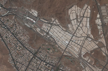
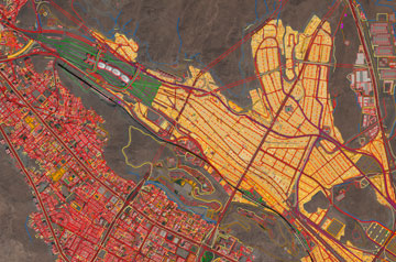
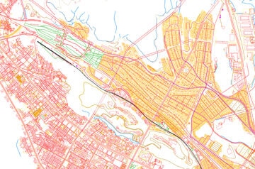
Vector feature extraction of a GeoEye-1 50cm satellite image covering Mina (Tent City) and Jamaraat Bridge, located along the eastern outskirts of Mecca, Saudi Arabia.

