Aerial Photography
Satellite imagery is more often in the news however aerial photography can offer multiple advantages, for example commercial
aerial photography is capable of higher resolution (level of detail) than the best-available commercial satellite imagery and can
cover very large areas with consistent seasonality, UAS can be ideal for covering smaller areas at very high detail.

Commercial USA Aerial Photography
LAND INFO partners with multiple large and specialty aircraft operators to offer 5 – 30cm ( 2.2 – 12 inch) resolution aerial imagery with multiple elevation options — LiDAR and PhoDAR/SGM (Semi-Global Matching.) Full coverage is available of Western Europe, all of the conterminous United States, Hawaii and Puerto Rico (limited coverage of Alaska.) Select areas in Canada, Eastern Europe, Japan, Australia and New Zealand are also available.
If our partners don’t have suitable off-the-shelf aerial content of your project area we can coordinate a custom flight for imagery, elevation or both.
NAIP (National Agriculture Imagery Program) – USA Lower 48 Only
NAIP is aerial photography acquired by USDA contractors during agricultural growing seasons and is an effective option to cover large areas with relatively recent imagery (states are often flown every other year – Contact LAND INFO for state availability by year.) Earlier imagery was 3-band (typically RGB, occasionally CIR) however all imagery is now 4-band.
Off-shelf CCMs (Compressed County Mosaics) are 3-band only, tonally balanced (not entirely seamless)/mosaicked by county, typically MrSID MG3 15:1. GeoTiff QQs (Quarter Quads) are now 4-band. Depending on project requirements
LAND INFO can custom process CCMs or QQ’s.
Except for some older 2m datasets, all NAIP imagery has been flown at 60 cm – 1m resolution, and is now standardized at 60cm, with the exception of state upgrades to higher resolution.
Starting in 2010 the NAIP accuracy spec improved to 6m CE 90 accuracy, older NAIP imagery accuracy specs called for ± 5m match to reference DOQQs (+/- 10m in the case of the 2m datasets).
Except for a small missing section of Southern Nevada and a few additional military-restricted areas, NAIP offers full coverage of the conterminous USA — LAND INFO offers a “best of the NAIP” compilation available for immediate delivery on external hard drive. The NAIP acquisition cycle is based on a minimum 3 year update of base ortho imagery.
USA Urban-Area High-Res
USGS and NGA (National Geospatial-Intelligence Agency) contractors have been acquiring higher-res ortho aerials for major metropolitan areas, sometimes extending to larger regions such as counties, smaller states, coastal areas and border regions.
The imagery is 2002 – present, typically natural color and 30cm (1 ft.) resolution but as high as 15cm (half foot) and as low as 1m. Unlike NAIP imagery the seasonality of the imagery varies. The main advantages of these datasets are higher resolution (level of detail), higher accuracy (often 3m RMSE) and tonal balancing / mosaic output by major metro area.
Please contact LAND INFO for an up-to-date list of all available datasets.
Legacy USA Aerial Photography Products:
Maxar (DigitalGlobe) Precision Aerial
Via a partnership between Maxar (DigitalGlobe) and Microsoft, a “Wall-to-Wall” 30 cm or better complete coverage aerial ortho mosaic is being acquired of the conterminous US and Western Europe (the program was previously referred to as “Clear 30” however Germany and select urban areas are being acquired at 15cm resolution). Most areas are already available for purchase — Contact LAND INFO for a status graphic to see if your area of interest (AOI) is available.
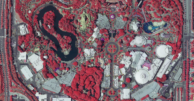
By employing a common sensor (UltraCamG) for all imagery collection, high quality is consistently maintained. Accuracy is an outstanding 4m CE 90 for standard tiles and 2.7m CE90 for high-value areas. All imagery is eye-pleasing, tonally balanced and cloud-free. In addition to the 30cm or better true/natural color imagery, 60 cm color infrared (CIR) is also available. As an off-the-shelf product, pricing is significantly less than custom aerial flights and refresh plans will maintain the currency of this premium quality imagery. Additional information and specifications available via the Maxar (DigitalGlobe) Precision Aerial downloadable .pdf. For pricing details and sample imagery, please Contact LAND INFO .
DOQQs (Digital Ortho Quarter Quads) – USA Only
DOQQs were the first US digital aerial photography products to be widely available on a national-level scale. Typically either 1m pan (gray-scale) or CIR (color infra-red) (some quads were re-flown and available as both pan and CIR), DOQQs cover almost all of the lower 48 states and most of Puerto Rico; only limited coverage is available of Alaska.
Each DOQQ covers an area of 3.75 minutes of latitude by 3.75 minutes of longitude (roughly four miles by four miles) and meets 1:12,000 NMAS (National Map Accuracy Standards, equivalent to 10m CE 90).
File Formats
- GeoTiff
- Tiff World .tfw
- NITF
- ER Mapper .ecw
- LizardTech MrSID .sid
- JPG2000 .jp2
- Idrisi .rst
- ERDAS Imagine .img
Delivery Options
LAND INFO provides several different delivery options:
- FTP
- CD-ROM
- DVD-ROM
- USB 2.0/USB 3.0 flash drive (thumb drive)
- External hard drive (USB 2.0/USB 3.0/FireWire 400/FireWire 800/eSata)
LAND INFO also offers custom services to optimize our offering of ortho aerial photography for project applications:
- Classification services including land-use, land-cover, vegetation and impervious surface mapping
- Vector feature extraction including roads/transportation, hydrology and building footprints
- Image processing such as re-projection, format translation, tonal balancing, mosaic output and wavelet compression
LAND INFO’s aerial products are typically available for North America and Western Europe, select additional regions are available.
Contact LAND INFO with your AOI (Area of Interest) and intended application; we’ll then confirm the best-available aerial options for your specific project.
