Image Classification & Object Based Image Analysis (OBIA)
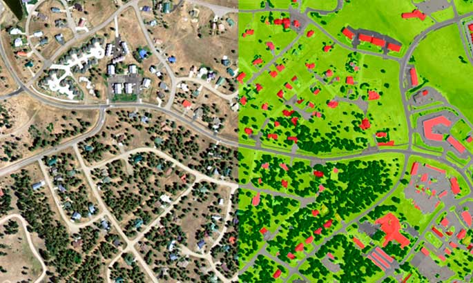
LAND INFO Object Based Image Analysis (OBIA):
Country-wide classifications to sub-meter object identification and capture. Our methodologies will extract valuable map data layers from satellite imagery (IKONOS, QuickBird, WorldView-1, GeoEye-1, WorldView-2, Pléiades Neo, Pléiades 1A, Pléiades 1B, WorldView-3, WorldView-4, and Medium-resolution satellite imagery such as SPOT-6, SPOT-7, Landsat, Sentinel, PlanetScope [Dove] and RapidEye), or your aerial/UAS imagery or LiDAR, point clouds or high-res DEMs.
Object Based Image Analysis utilizing Trimble’s eCognition and other software programs has the ability to make smart class decisions based on spectral, shape, size and class relationships utilizing image objects (image objects are groups of spectrally similar pixels.) Object Based Image Analysis also has the ability to ingest and utilize temporal imagery and ancillary GIS data layers to make smarter class decisions, enhanced classifications and change detection outputs. LAND INFO classifications can be exported to raster and vector formats for easy GIS integration.
Object Based Image Analysis Advantage – Spectral Signature, Size, Shape, Proximity, Statistics, Temporal
OBIA Reduces Costs and Speeds Project Turn-Around
Object Based Image Analysis will reduce costs and speed turn-around on your next land-use/land-cover, vegetation, impervious surface or change detection mapping project. Examples of features that can be mapped or differentiated include:
- Vegetation
- Buildings & Roof-types
- Agricultural, Residential, Parks
- Roads, Parking Lots
- Rivers, Lakes, Swimming Pools
- Individual Parcel Mapping (Vegetation, Impervious)
- Urban Density
- Forest Fragmentation
- Feature Statistics – Export .CSV object statistics (Mean, NDVI, Size, Length, Width…) OBIA Export – Raster, Shapefile, GDB, .CSV
Datasets can be optimized for specific use cases such as RF engineering, visualization/simulation, poverty/economic indicator mapping, precision agriculture, forestry, utility corridor right-of-way encroachment, wild-land fire fuel category/risk assessment, water resources and storm-water management.
LAND INFO Galleries
- Gallery: 3D Buildings, Trees & Land-Use/Cover (Clutter)
- Gallery: 2D Classification and Object Based Image Analysis
- Gallery: Digital Elevation Models (DEMs)
- Gallery: High and Medium Resolution Satellite Imagery
- Gallery: Geodata for Wireless Telco
- Gallery: 2D Vector Feature Extraction
- 3D Terrain Representation Format Examples
