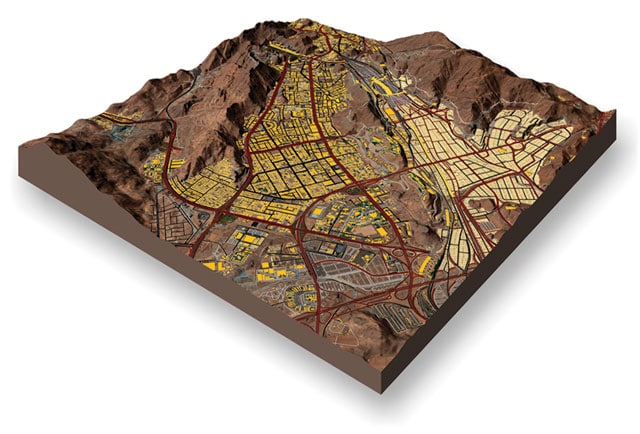
Road and building vector feature extraction, vegetation mapping and DTM of Mina, Mecca, Saudi Arabia
Image derived from 50cm stereo satellite imagery.
LAND INFO employs a mix of manual, semi-automated and fully automated mapping techniques in order to deliver optimal quality, turn-around time and cost-savings.
LAND INFO Can Turn Your Imagery into Valuable Map Information

Image credit LAND INFO Worldwide Mapping, LLC, includes material Copyright © DigitalGlobe Longmont, Colorado. All rights reserved.
Object Based Image Analysis will reduce costs and speed turn-around on your next land-use/land-cover, vegetation, impervious surface or change detection mapping project.
Vector Feature Extraction: accurate extraction of layers such as buildings, hydrology, transportation and other infrastructure.
Contact LAND INFO
For Your Next Mapping Imagery Project
